When to Hire a Local Drone Pilot vs a Nationwide Turnkey Capture Service
Understanding the Two Approaches to Drone Aerial Data
If you need aerial imagery or 3D data of a property, a construction site, or a piece of infrastructure, you have two broad routes. One is to find a local drone pilot who can fly the site on an ad-hoc basis. The other is to use a nationwide turnkey drone capture service that handles everything from flight planning to data delivery. Each option has its strengths, and the right choice depends on the scale of your project, the consistency you need, and how much coordination you want to manage yourself.
This article compares the two approaches in practical terms. It covers what each looks like on the ground, the trade-offs in quality and reliability, and the situations where one clearly suits better than the other. By the end you should have a clearer sense of which route fits your next project.
What Local Drone Pilots Offer
A local drone pilot typically works as a freelance operator or runs a small business serving clients within a limited radius. They own their equipment, hold the necessary remote pilot licence, and usually have experience flying in the local area. You contact them directly, describe what you need, and they come to the site to capture the data.
This model works well for one-off jobs or small sites where the requirements are straightforward. For example, a real estate agent wanting rooftop photos or a small construction firm needing a single orthomosaic might find a local pilot quick to mobilise and often cheaper per flight than a larger service provider. The pilot can also be flexible about timing, willing to fly early in the morning or late in the afternoon if the light is better.
The catch is that you are relying on one person's availability, equipment condition, and expertise. If the pilot is booked on another job, you wait. If their drone goes down, you wait longer. And because local pilots tend to work alone, the data processing - stitching images together, generating point clouds, or creating elevation models - may fall back on you. Many pilots deliver raw images and expect you to handle the mapping software yourself.
What Nationwide Turnkey Drone Capture Provides
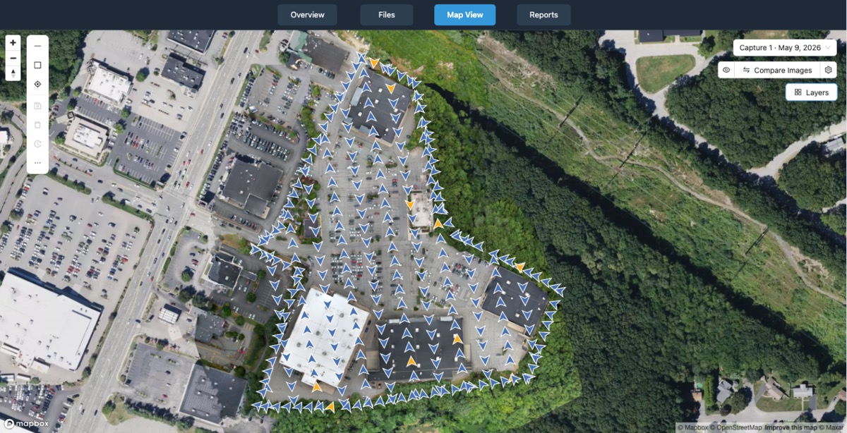
A nationwide turnkey drone capture service is a different beast. The idea is that you make one request, and the provider manages the entire chain: scheduling a certified pilot, flying the site, processing the data into a usable format, and delivering it to a platform or file. You do not coordinate with the pilot, check weather windows, or worry about processing software. The service absorbs all those steps.
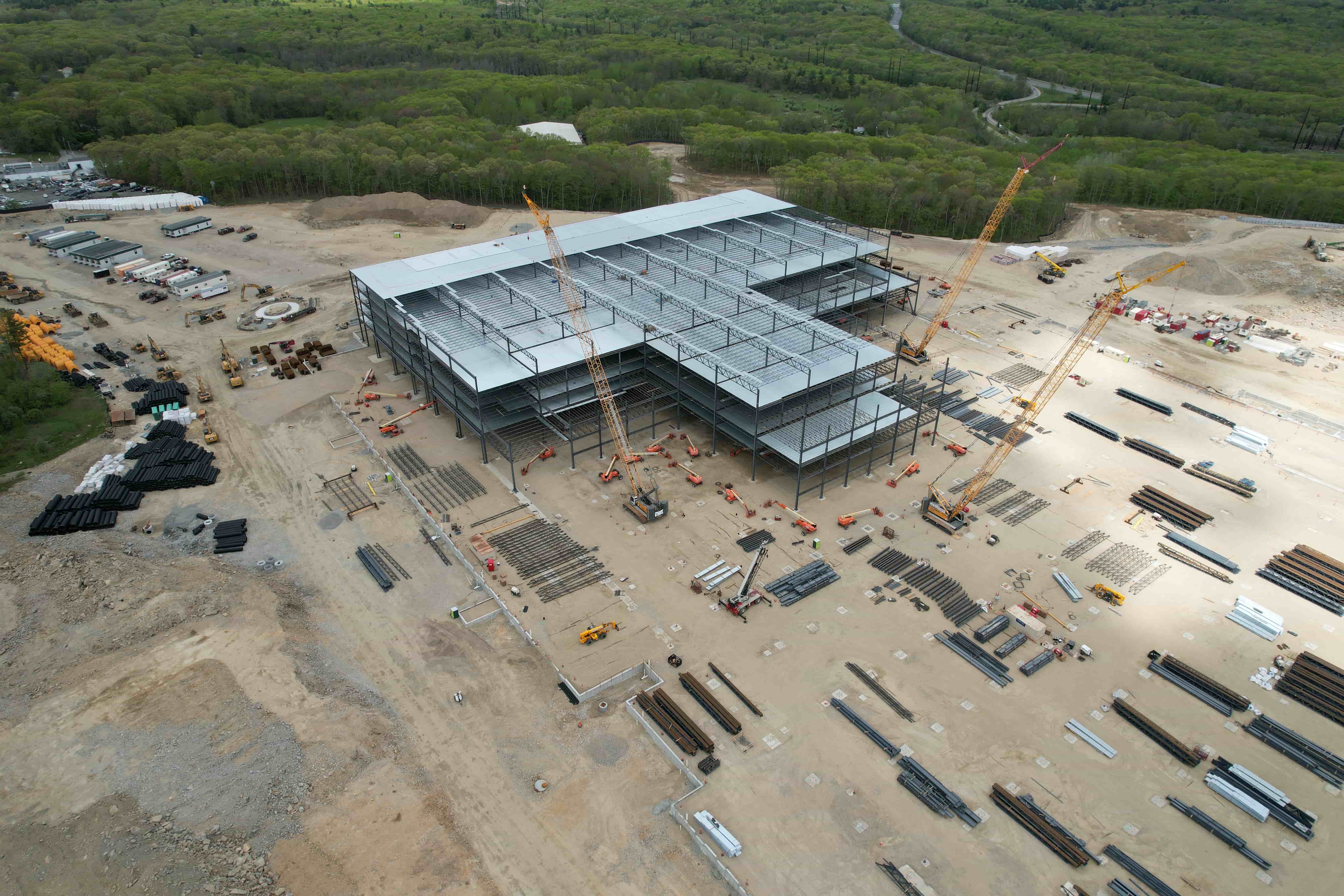
Because these providers operate across multiple regions, they have a pool of pilots and backup equipment. If one pilot is unavailable, another can step in. This redundancy matters for time-sensitive projects such as construction progress monitoring, where missing a flight window could delay a payment milestone or a compliance report. The data is also processed consistently. Every job follows the same workflow, so you can compare a site from month to month without worrying that different pilots used different settings or stitching methods.
For organisations that need repeat captures of many sites - think a telecom company checking hundreds of towers, or a solar farm operator inspecting panels quarterly - the turnkey model removes the overhead of finding and vetting a new pilot each time. You get a predictable deliverable, often uploaded directly to a cloud platform where you can view, measure, and share the data.
Quality and Consistency
Consistency is where the two approaches diverge most sharply. A local pilot can produce excellent results, but the quality depends on that pilot's skill, their current equipment, and the conditions on the day. If you use a different local pilot for each site, you may receive data sets that are hard to compare because the resolution, overlap, or georeferencing standards differ.
A nationwide turnkey capture service standardises those variables. The pilots follow the same capture protocol, the data flows through the same processing pipeline, and the output is checked against the same quality criteria. For projects that span multiple states or require consistent metrics - such as cut-and-fill volumes on a linear construction job - this consistency can be a dealbreaker. It allows you to treat the data as a reliable input rather than something you have to clean and normalise yourself.
Cost and Value
On a per-flight basis, a local pilot is often cheaper. There is no corporate overhead, no nationwide scheduling system, and no processing platform to fund. For a single small site, you might pay less for the raw capture and handle the mapping yourself. That can be the most cost-effective path if you already have the software and the time.
The turnkey model shifts value from the flight itself to the entire workflow. The price includes pilot management, data processing, and often a platform for viewing and measuring the results. If you factor in your own time spent finding pilots, checking their insurance, processing raw images, and troubleshooting errors, the all-in cost can be competitive. For projects with many sites or repeated captures, the turnkey approach often saves money because it eliminates the hidden labour of coordination and data wrangling.
When to Choose a Local Pilot
- You have a single small site and you or someone on your team can process the raw data.
- The site is in a remote area where a nationwide provider may not have a pilot nearby.
- You need footage on very short notice and the local pilot is available immediately.
- The project requires specialised flying, such as indoor inspections, that a generalist pilot may handle better than a standardised service.
- You already have a trusted relationship with a pilot and know their work quality.
In these cases, the flexibility and lower upfront cost of a local pilot make sense. Just be clear about what the pilot delivers - raw images, stitched orthomosaics, or processed point clouds - to avoid surprises.
When to Use a Nationwide Turnkey Service
- You need consistent data across multiple sites, possibly in different states.
- You require processed deliverables such as georeferenced orthophotos, digital elevation models, or 3D meshes.
- The project has a tight schedule where a single pilot's availability could cause delays.
- You want the data delivered to a central platform where your team can view, measure, and share it without installing software.
- You prefer to pay a single invoice for the whole job rather than managing separate pilot fees and processing costs.
For recurring work such as construction progress tracking, environmental monitoring, or infrastructure inspection, the turnkey model removes operational friction. Each capture follows the same recipe, so comparisons over time are meaningful.
Practical Considerations for Both Approaches
Whichever route you take, several practical points apply. Always confirm what the deliverable will be. A local pilot may hand you an SD card with images; a turnkey service may give you a link to an online viewer. Both are useful, but they serve different workflows. Check whether the data will be georeferenced and what coordinate system it uses. If the data needs to align with existing GIS layers, that matters.
Weather is another factor. Drones cannot fly in rain, high wind, or low cloud. A local pilot may be able to reschedule quickly because they are just down the road. A turnkey provider may have a backup pilot in the same region, but the rescheduling still takes time. For time-critical projects, build buffer days into the schedule.
Also consider data security. Some sites, such as critical infrastructure or defence facilities, require that data never leaves the country or is processed on specific servers. Ask both local pilots and turnkey providers how they handle data storage, transmission, and retention. A reputable provider will document their practices.
The Role of a Platform
Once the data is captured, you need a way to use it. Raw images are of limited value. Processed orthomosaics and 3D models need a viewer that lets you take measurements, add annotations, or share with stakeholders. This is where a platform like the one behind National Drone Services drone mapping services comes into play. The platform handles uploading, processing, organising, visualising, comparing, measuring, and sharing drone aerial data. It turns captures into actionable information without requiring you to own specialised software.
If you hire a local pilot, you may still want such a platform to process and manage the data. If you use a nationwide turnkey service, the platform is often part of the package. Either way, having a single place where all your data lives, searchable and measurable, transforms a collection of flights into a coherent asset library.
Making the Decision
Start by listing what matters most for your project. Is it cost per flight? Consistency across sites? Ease of coordination? The speed of getting usable data? A local pilot can be fast and inexpensive for a single job but may not scale. A nationwide turnkey capture service provides consistency and removes coordination overhead but costs more per flight on paper.
For a one-time roof inspection, a local pilot is usually the sensible choice. For a portfolio of twenty cell towers that need quarterly inspections, the turnkey model is almost always the better fit. The middle ground - a handful of sites captured irregularly - is where the decision is less clear. In that case, consider trying both approaches on a small scale. See which deliverable you find easier to work with and which workflow disrupts your team less.
Many organisations end up using both: local pilots for quick, small jobs and a turnkey service for larger, recurring, or multi-site projects. There is no rule that you must pick one. The key is to understand the trade-offs so you choose deliberately rather than by default. Services like National Drone Services drone mapping services exist to make the turnkey path simple, but the right choice always depends on your specific needs, timeline, and tolerance for managing details.
National Drone Services on social media
 Facebook